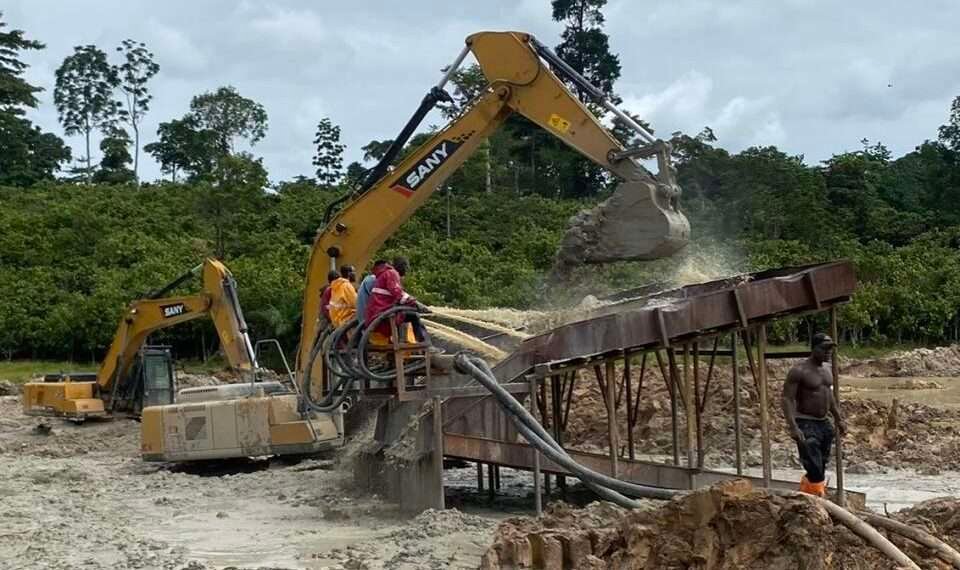
Guskin Gold Corp has announced the initiation of a detailed geological and regolith mapping program on the Kukuom Gold Project located in the renowned Sefwi-Bibiani Gold Belt in Ghana, Africa.
The detailed geological and regolith mapping is currently being carried out across the area of the “Open Pit” and extending East and West of the favourable contact zones of the metasedimentary and metavolcanic units that host gold-quartz vein systems.
The detailed surface geological and structural mapping program, alongside a rock chip sampling program, has begun in the most prospective part of the Kukuom concession. The mapping is being done along gridlines of 100-meter spacing and 50-meter line spacing over the main magnetic anomaly as previously reported.
Mr. Francis Agezo, Guskin Gold’s Director of Exploration noted that current geological mapping data and existing geology maps on the Kukuom property are preliminary and regional in nature.
“This warrants a comprehensive and more detailed surface geological and regolith mapping program to be conducted in tandem with rock chip sampling. The main objective of this program is to constrain the rock units in the mapped area, investigate the occurrence of subdued but consistent low-tenor gold-in-soil values and occasional spiky soil-gold values and relation to the units, generate a reliable regolith interpretation and enhance the litho-structural knowledge and understanding.”
Mr. Francis Agezo
The Presence of Magnetic Structures
Meanwhile, the airborne data interpretation undertaken earlier has confirmed the presence of six (6) distinctly high magnetic signatures, which are circular-elliptical shaped and could be indicative of shear zones that may have strike lengths in excess of 2,000 meters and are the primary targets to host gold-quartz vein systems.
One of such high magnetic anomalies (Target 1), is coincident with the Kukuom artisanal “open pit” prospect, where high-grade gold quartz vein systems in the artisanal open pit workings are featured.
Target 1 which lies within the broader area being mapped, has since been investigated by soil geochemistry on a 200-meter by 50-meter grid and ground magnetic and Induced Polarization (IP) surveys.
The current detailed field mapping was preceded by ground geophysical surveys which were carried out to get a better understanding of the bedrock geology. The ground magnetics aimed to assist in a better definition of bedrock structure and IP was very effective in outlining zones in bedrock with disseminated sulfides, which are typically associated with gold-bearing structures and vein systems.
The detailed field mapping exercise will further constrain the lithological units within the mapped area that are most favorable for gold mineralization; it will allow ground-checking or ground-truthing of the prominent magnetic anomalies interpreted from airborne and ground data.
Additionally, the regolith data collected will also aid in the compilation of a comprehensive regolith map. The distribution of laterites and transported regolith materials and their effects on geochemical response in the mapped area will be studied. Rock chip, grab, and laterite sampling will be undertaken in tandem with field mapping program. In areas where outcrops are located, rock chip/grab sampling of rock exposures will be taken.
Mr. Agezo explained that the detailed geological mapping exercise, when completed in prospective areas, will allow the compilation of detailed geological maps in order to develop a more detailed geological and structural framework for mineralization in the prospect area and in the entire mapped area.
“Attention will be given to the relationship between the mafic volcanic rocks; the metasediments, intrusive bodies, and the contact zone. These are considered to provide the right rheological contrast and zones of weaknesses to create the fluid pathways needed for the transportation and deposition of the mineralized fluid.
“A comprehensive detailed geological and structural analysis of the mapped area would be integrated with soil geochemistry, aeromagnetic and ground geophysics data and responses and which will eventually further constrain drill targets and help identify other targets.”
Mr. Francis Agezo
Mrs. Naana Asante, Guskin Gold’s CEO, Director, and Chairwoman, on her part, affirmed that a successful outcome will allow them geologic confidence to define high-priority targets for the upcoming drill program and their work towards producing a mineral resource recognized by international reporting standards such as the Canadian NI 43-101 or Australian JORC (2012). “We look forward to continuing to release timely updates to our JV partners, suppliers, government, and shareholders, keeping everyone informed as we develop, improve, and expand operations in Ghana,” she noted.
The Kukuom Gold Project Significance
The Kukuom Gold Project is a Joint Venture Partnership with Danampco Company whereby Guskin Gold is the exclusive operator with a seventy (70%) percent interest.
The license area is 156 square kilometers and the Kukuom Gold Project is highly prospective, spatially related to major mines including Newmont’s Ahafo Gold Mine (23Moz) located approximately 30km north of the Kukuom property, and Asante Gold’s Chirano Gold Mine (5Moz) located approximately 45km south-southeast of Kukuom and their Bibiani Gold Mine (7Moz) located approximately 25km southeast.
Francis Lovebridge Agezo, Guskin Gold’s Director of Exploration, participated in the exploration, discovery, and development of Cluff’s Ayanfuri Gold Mine and Red Back’s Chirano Gold Mine in Ghana. He played a key role in Redback’s expansion in Ghana before its takeover by the Lundin Group and later Kinross.
Notably, on April 25, 2022, Kinross Gold Corp. (KGC) announced the sale of the Chirano Gold Mine for $225 Million to Canadian Asante Gold (ASE); Asante having previously gained the Bibiani Gold Mine for $90 Million from Australian Resolute Mining (RSG) in August 2021.


