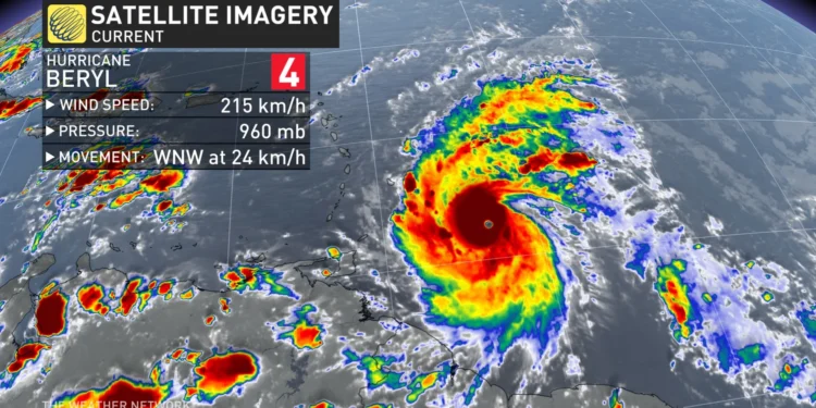
On Monday, July 1, Hurricane Beryl is expected to make landfall in the southeast Caribbean as a powerful Category 3 storm.
Previously, Beryl became the earliest Category 4 storm to form in the Atlantic, driven by record-warm waters.
Authorities have issued hurricane warnings for Barbados, Grenada, St. Lucia, Tobago, and St. Vincent and the Grenadines. As thousands of residents seek refuge in homes and shelters, the region braces for impact.
“It’s going to be terrible,” stated Ralph Gonsalves, Prime Minister of St. Vincent and the Grenadines. He urged citizens to stay indoors and “wait this monster out.”
The last significant hurricane to strike the southeast Caribbean was Hurricane Ivan nearly 20 years ago, which resulted in the deaths of dozens in Grenada.
As of early Monday, Beryl was situated 125 miles (200 kilometers) east-southeast of Grenada. With maximum sustained winds of 120 miles (195 kilometers) per hour, the storm was moving west at 20 mph (31 kph).
Beryl is a compact system, with hurricane-force winds extending 35 miles (55 kilometers) from its center.
A tropical storm warning is in effect for Martinique and Trinidad, while a tropical storm watch has been issued for Dominica, Haiti’s entire southern coast, and from Punta Palenque in the Dominican Republic west to the border with Haiti.
Forecasters predict a life-threatening storm surge of up to 9 feet (3 meters) where Beryl will make landfall, accompanied by 3 to 6 inches (7.6 to 15 centimeters) of rain for Barbados and nearby islands.
Some areas, particularly Grenada and the Grenadines, to receive up to 10 inches (25 centimeters).
“This is a very dangerous situation,” warned the National Hurricane Center in Miami.
While Beryl is expected to weaken slightly over the Caribbean Sea, it is projected to pass just south of Jamaica and later head toward Mexico’s Yucatan Peninsula as a Category 1 storm.
“It should be emphasized that Beryl is forecast to remain a significant hurricane during its entire trek across the Caribbean region,” the National Hurricane Center noted.
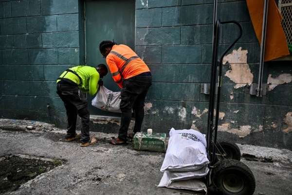
In preparation, officials in several southeast Caribbean islands have announced controlled shutdowns of electricity and water services, urging people to seek shelter.

They have also warned of potential landslides and flash flooding, resulting in the closure of schools, airports, and government offices.
Michael Beckles, a resident of Barbados, expressed his concerns.
“As prepared as we can try to be, there are a lot of things that we can’t control. Electricity probably will go. We’ll have issues with water. There are a lot of houses that are not ready for a storm like this.”
Michael Beckles,
Historic Hurricane
Beryl’s rapid intensification from a tropical depression to a major hurricane in just 42 hours is a rare occurrence in Atlantic hurricane history.
Typically, such strength is not observed until around September 1, according to hurricane expert Sam Lillo.
Beryl also became the earliest Category 4 Atlantic hurricane on record, surpassing Hurricane Dennis, which achieved Category 4 status on July 8, 2005.
“This is a dangerous hurricane for the Windward Islands,” warned hurricane specialist and storm surge expert Michael Lowry. “It’s going to be a very serious situation.”
The storm’s intensity has been fueled by record-warm waters, which are currently hotter than they usually are at the peak of hurricane season in September.
Additionally, Beryl has set a new record for forming the farthest east in the tropical Atlantic in June, breaking a record set in 1933, according to Colorado State University hurricane researcher Philip Klotzbach.
As such, government officials are also monitoring a cluster of thunderstorms following a similar path, with a 70% chance of developing into a tropical depression.
READ ALSO: Evaluating Current Government’s Policies on Creative Art Sector, a Necessity


