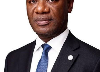


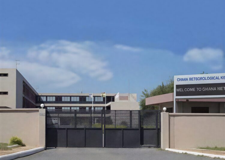
The Deputy Director of Ghana Meteorological Agency, Dr Ignatius Kweku Williams has indicated that rainfall intensity across southern Ghana is expected to reduce in the coming hours, offering cautious relief to residents recovering from the devastating floods in Accra.
The GMET Deputy Director reported that weather models showed continued moisture over southern Ghana, particularly along the coastal belt, forest zones and adjoining inland areas. He explained that these conditions could still trigger rainfall, though the projected volumes remain significantly lower than what was recorded during the previous downpour.
Dr Williams stated that northern Ghana appeared relatively drier, making widespread rainfall less likely across that part of the country. He added that any showers expected in the northern and northeastern belts would likely remain isolated and limited in coverage.
The GMET Deputy Director also pointed out that rainfall activity may increase slightly by afternoon. Even so, he emphasised that the strongest weather signals are concentrated around the coast and forest areas.

“We are expecting lower amounts of rainfall compared to Monday, with most of the showers likely to remain isolated across the affected zones.”
Dr Ignatius Kweku Williams
The Deputy Director further explained that forecasting is a probability based science shaped by atmospheric variables and predictive modelling. As a result, precise rainfall quantities can only be estimated within a defined range using available instruments.
He disclosed that current projections placed expected rainfall between 10 and 30 millimetres spread across the day. The estimate, he noted, suggests a far less severe weather event than the Monday’s rainfall that caused extensive flooding across Accra.
Additionally, Dr Williams urged residents to continue monitoring official weather updates in case atmospheric conditions shift unexpectedly. He emphasised that weather systems are dynamic and can change within short periods.
The GMET Deputy Director also offered practical reassurance to households living in flood prone communities. He indicated that the projected rainfall volume should be manageable in areas already drained of floodwater.
Additionally, he encouraged the public to stay alert without panicking as authorities continue recovery efforts. The emphasis, he said, is on preparedness and timely access to weather information.
Ghana Meteorological Agency Cites Equipment Limitations In Flood Forecasting
The deadly Accra floods have also reignited debate over Ghana’s early warning systems, with questions emerging over whether stronger forecasting infrastructure could have improved emergency preparedness before the disaster unfolded.
Dr Ignatius Kweku Williams acknowledged that the meteorological agency issued rainfall alerts before the storm intensified, explaining that an evening forecast released around 6 pm had already indicated a probability of rain. He clarified that the 11 pm update served as a routine forecast revision and was not the first warning issued.
Addressing Honourable Muntaka’s criticism over forecast accuracy, the GMET Deputy Director explained that the agency initially anticipated moderate rainfall based on the storm’s movement from neighbouring countries including Benin and Togo. However, the weather system behaved differently after entering Ghana’s airspace.

He stated that the storm slowed significantly once it crossed into Ghana, causing heavy cloud concentration over specific localities. That unexpected stagnation allowed large volumes of rainfall to accumulate over Accra within a short period.
“As at 6 pm, we did not know the system would stagnate and release that volume of rainfall within one locality.”
Dr Ignatius Kweku Williams
Discussing the comparisons with advanced forecasting systems in places such as California pointed out by the Interior Minister, Dr Williams explained that such comparisons must consider massive differences in technological capacity and investment.
The GMET Deputy Director noted that countries with advanced warning systems rely heavily on radar networks, automated weather stations and high resolution monitoring tools. Ghana, he said, still depends largely on satellite imagery and global weather models for many of its predictions.
He emphasised that this limitation affects the precision of rainfall projections and reduces lead time for emergency evacuation decisions. Forecast estimates, he explained, may therefore vary depending on real time atmospheric shifts.
Furthermore, Dr Williams called for strategic investment in radar technology capable of tracking thunderstorm formation and rainfall concentration. Such systems, he indicated, would significantly improve forecasting precision and strengthen disaster response planning.
“We need our own radar systems and stronger weather infrastructure if we are to improve early warning and support faster emergency action.”
Dr Ignatius Kweku Williams
He also highlighted the importance of regional monitoring since weather systems affecting Ghana often originate beyond national borders. Tracking storm behaviour across West Africa, he noted, would improve predictive capacity before severe rainfall reaches the country.
READ ALSO: Interior Minister Calls For Stronger Interagency Planning To Manage Floods