


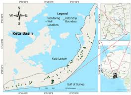
Ghana’s efforts to unlock new offshore petroleum discoveries have received a significant boost following the launch of a major subsurface imaging project designed to improve geological understanding of the Keta Basin and support future exploration activity.
The Petroleum Commission has signed an agreement with global energy data and intelligence company TGS to develop a new Gulf of Guinea 2D-cubed Project, an initiative expected to provide oil and gas companies with a comprehensive view of one of Africa’s least explored offshore basins.
The project marks another step in Ghana’s strategy to sustain exploration activity beyond its established producing fields while strengthening the country’s long-term upstream petroleum prospects.
By integrating decades of existing seismic data into a single modern dataset, the initiative is expected to reduce exploration uncertainty, improve prospect evaluation and support future licensing decisions without requiring immediate acquisition of new seismic surveys.
Coming at a time when Ghana is seeking to reverse declining crude oil production and attract fresh upstream investment, the agreement signals continued efforts by the Petroleum Commission to enhance the quality of technical information available to prospective investors.
Industry observers believe better access to high-quality subsurface data could improve confidence in frontier acreage and encourage renewed exploration interest in offshore Ghana.
Unified dataset to improve exploration decisions
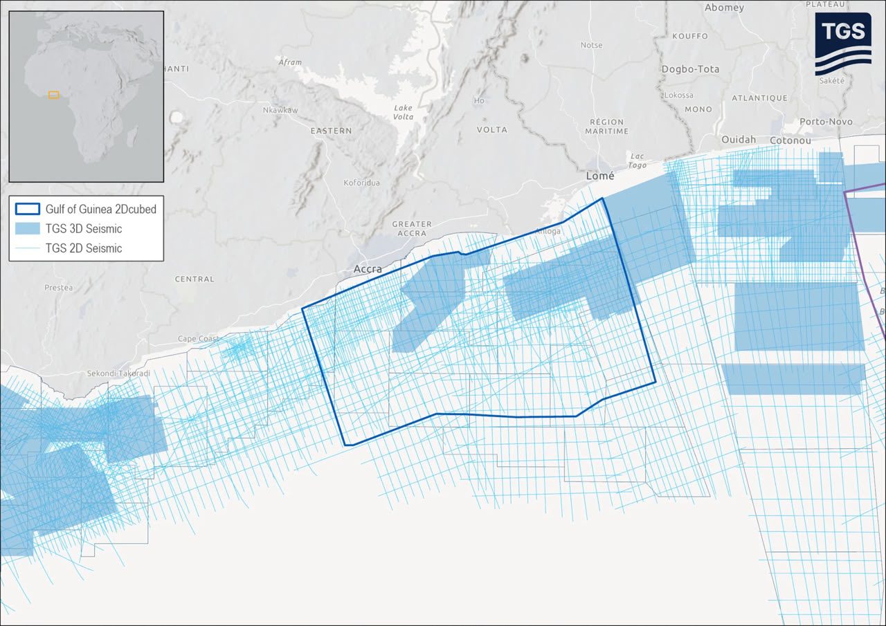
Under the agreement, Phase One of the Gulf of Guinea 2D-cubed Project will focus on the Keta Basin, where TGS will combine 5,500 square kilometres of existing 3D seismic data with more than 14,700 kilometres of 2D seismic data collected from multiple surveys.
The information will be integrated into a 25,300-square-kilometre 2D-cubed dataset covering both shallow shelf and deepwater portions of the basin.

Rather than acquiring entirely new seismic surveys, the project applies TGS’ proprietary 2D-cubed technology, which transforms existing multi-vintage 2D and 3D seismic information into a structurally consistent three-dimensional seismic volume.
The technology uses advanced interpolation techniques to bridge gaps between legacy datasets while suppressing migration artefacts that often reduce image quality in older seismic surveys.
The result is expected to be a continuous, modern-quality dataset capable of providing explorers with a clearer understanding of subsurface structures across the basin.
For companies considering exploration opportunities in the Keta Basin, the project eliminates the need to interpret multiple disconnected seismic surveys individually.
Instead, exploration teams will have access to a unified geological framework that supports basin-wide prospect evaluation and faster technical decision-making.
Supporting Ghana’s exploration ambitions
Although Ghana remains one of Africa’s established oil-producing nations, recent years have highlighted the importance of sustaining exploration activity to secure future production.
Declining output from mature fields has intensified calls for renewed investment in frontier basins capable of delivering the country’s next generation of discoveries.
The Keta Basin has long been regarded as one of Ghana’s most prospective yet underexplored offshore regions.
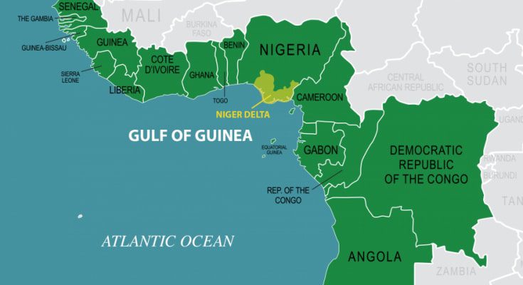
According to TGS, the basin contains one of Africa’s largest underexplored deepwater fan systems, making it an area of growing interest for international exploration companies seeking new opportunities along the Transform Margin of West Africa.
Improved geological understanding is expected to strengthen future licensing programmes while helping companies identify and mature exploration prospects more efficiently.
The Petroleum Commission has consistently emphasised the importance of maintaining high-quality geological data to support transparent licensing processes and attract technically capable investors into Ghana’s upstream sector.
The latest agreement aligns with that objective by making modern subsurface interpretation available without waiting for fresh offshore seismic acquisition campaigns, which are often expensive and time-consuming.
Technology aimed at reducing exploration risk
Exploration success increasingly depends on access to reliable geological information.
By integrating legacy datasets into a single structural framework, TGS says the project will enable exploration companies to evaluate petroleum systems more effectively while reducing uncertainties associated with fragmented seismic interpretation.
Executive Vice President for Multi-Client at TGS, David Hajosky, said the project would provide companies with greater confidence when assessing exploration opportunities within the basin.
The Keta Basin holds real untapped potential, and our customers need a clear, reliable view of it to act with confidence.
David Hajosky, Executive Vice President, Multi-Client, TGS
He explained that combining historical datasets into one comprehensive volume would provide explorers with a practical foundation for prospect maturation.
By bringing decades of 2D and 3D data together into a single 2D-cubed volume, we are giving explorers a ready-to-use foundation for prospect maturation, reflecting TGS’ continued commitment to delivering high-quality seismic data that identifies new resource potential and supports increasing exploration activity across the Transform Margin of West Africa.
David Hajosky
Industry experts note that exploration decisions often hinge on the quality and consistency of subsurface data. Modern imaging technologies capable of improving geological interpretation have therefore become increasingly important in attracting upstream investment, particularly in frontier basins where drilling risks remain relatively high.
Positioning Ghana for future licensing activity
The agreement also comes as Ghana continues efforts to maintain investor interest in its upstream petroleum sector despite a more competitive global exploration landscape.
Access to comprehensive technical data is regarded as one of the strongest incentives for exploration companies evaluating frontier acreage.
A unified basin-wide seismic interpretation enables investors to identify geological trends, evaluate structural traps and prioritise drilling targets more efficiently than fragmented datasets.
Such information is expected to support future licensing exercises while enhancing the competitiveness of Ghana’s offshore acreage.
The Petroleum Commission has in recent years placed considerable emphasis on improving data accessibility and strengthening technical evaluation processes as part of broader efforts to sustain upstream investment.
Projects such as the Gulf of Guinea 2D-cubed initiative demonstrate the growing role of advanced digital technologies in supporting petroleum exploration.
They also reflect an industry-wide shift towards extracting greater value from existing geological datasets before committing significant capital to new seismic acquisition.
Final products from the first phase of the project are expected to be completed during the first quarter of 2027.
Once delivered, the dataset is expected to provide exploration companies with a significantly enhanced understanding of the Keta Basin’s petroleum potential, supporting future prospect screening and licensing activity.
For Ghana, the initiative represents more than a technological upgrade. It strengthens the country’s long-term exploration strategy by improving the quality of geological information available to investors, reinforcing confidence in frontier acreage and positioning the Keta Basin as an increasingly attractive destination for upstream petroleum investment as the search for new discoveries continues.
READ ALSO: Ministry of Health Debunks False Ebola Claims Circulating Online