

The World Meteorological Organization (WMO) has warned that the strengthening El Niño event is forecast to reach unprecedented levels by the end of 2026, potentially reshaping weather patterns and increasing risks for communities, ecosystems and economies across the World.
Sea-surface temperatures in the central and eastern tropical Pacific are expected to rise to record levels in October, November and December as El Niño intensifies toward a forecast peak in December.
According to WMO Secretary-General Celeste Saulo, “El Niño is firmly established and strengthening rapidly.”
“WMO forecasts indicate a near-100 per cent likelihood that it will persist through February 2027, potentially being one of the strongest since at least 1950.”
Celeste Saulo
The latest monthly Global Seasonal Climate Update from the WMO projects that the Niño 3.4 index, which measures sea-surface temperature anomalies across the central-eastern equatorial Pacific, will reach approximately 3.7°C above normal during the October-December period.
If realised, the seasonal average would be the highest recorded since observations began and would surpass the previous record of 2.6°C between November 2015 and January 2016.
The latest projection marks a rapid escalation in ocean temperatures associated with the current El Niño. The Niño 3.4 anomaly rose from an average of 1.6°C above normal in June 2026 to 2.5°C above normal in August, providing a strong indication of the pace at which the event has strengthened.
Moreover, the near-certainty of El Niño continuing through February is based on a consensus from 13 national and international forecasting centres, drawing on real-time observations from ocean buoys, satellites and radiosondes coordinated through the WMO.
WMO Secretary-General explained that El Niño does not create additional heat but releases heat stored beneath the ocean surface. A stronger event can therefore contribute to exceptionally warm global temperatures, particularly when it develops against a background of already elevated ocean heat.
Global Heat and Rainfall Patterns Set to Shift
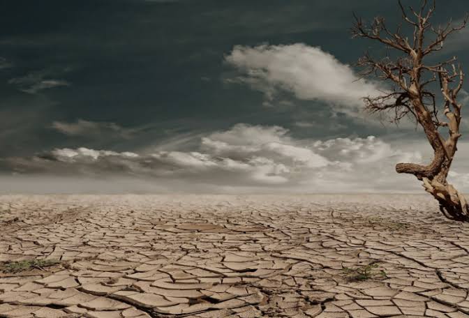
The strengthening El Niño is expected to coincide with continued elevated global temperatures, reinforcing concerns about heat extremes in the final quarter of the year.
The WMO’s seasonal update forecasts a strong likelihood of above-average temperatures across large areas between October and December. The projection does not mean that every location will experience unusually high temperatures every day, but it indicates a strong seasonal tendency towards warmer-than-normal conditions and a greater likelihood of heat extremes.
The outlook follows a period of exceptional global warmth. Earth recorded its hottest August on record, according to monthly assessments from the European Union’s Copernicus Climate Service, the United States National Oceanic and Atmospheric Administration and NASA. Global sea-surface temperatures also reached an observed record high during the month.
Against that backdrop, the emergence of a potentially record-strength El Niño could further influence temperature patterns during the closing months of 2026.
The WMO cautioned, however, that seasonal projections should not be interpreted as replacements for national or local weather forecasts. Instead, they indicate where wetter or drier conditions are more likely over an extended period.
Moreover, there are especially noticeable geographical differences in the rainfall forecast. A strong wet signal is expected across the central and eastern equatorial Pacific, particularly east of the International Date Line.
Wetter-than-normal conditions are also forecast across the Greater Horn of Africa, parts of Central Asia and coastal East Asia, northern areas of the Arabian Peninsula, parts of North America south of 45 degrees north and southeastern South America.
These conditions could have significant consequences for agriculture, water management and disaster preparedness in regions where excessive rainfall can quickly translate into flooding, landslides and damage to infrastructure.
The Greater Horn of Africa is among the regions highlighted for increased chances of above-normal rainfall. At the same time, the WMO expects a broad dry signal across the western Pacific and equatorial Atlantic, extending across the South Pacific towards the southern tip of South America.
Also, drier-than-normal conditions are forecast across the Indian subcontinent, southern Central America and parts of the Caribbean, as well as northwestern South America.
The contrasting outlook illustrates one of the defining characteristics of El Niño: its effects are not uniform. While some regions face increased rainfall and flood risks, others may experience prolonged dryness and heightened pressure on water and food systems.
WMO Steps Up Global Preparedness Efforts
With the forecast pointing to a potentially exceptional El Niño, the WMO and its members have increased efforts to ensure that governments and other institutions can prepare for the associated risks.
National Meteorological and Hydrological Services, alongside regional climate outlook forums, are providing regular updates to decision-makers to support planning across sectors that could be affected by changes in temperature and rainfall.
WMO is also coordinating information across the United Nations system and with humanitarian organisations through its Coordination Mechanism.
The objective is to strengthen preparedness and risk management before climate-related impacts intensify.
READ ALSO: GSE Bears Strike Hard as Market Loses GH¢3.3bn in a Single Day